A political map of the World. Within new boundaries. A3
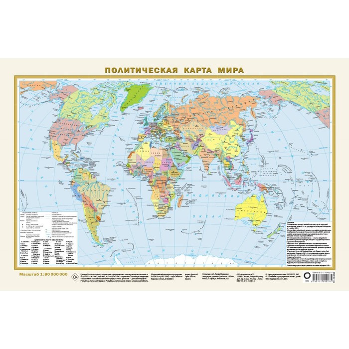
This A3 format map has a size of 440x290 mm and is covered with a polymer film on the front side. On the political map of the world on a scale of 1:80,000,000 (1 cm 800 km), all independent states of the world with their capitals, as well as ownership and territory with special status are shown.
The Russian Federation is represented within new borders, including the Republic of Crimea, Sevastopol, DPR, LPR, Zaporizhzhya and Kherson regions. The settlements on the map are given in three gradations of the number: more than 1 million inhabitants, from 100 thousand to 1 million, less than 100 thousand inhabitants.
The card is packed in a transparent sleeve from PVC 290 mm long and 40 mm in diameter.
Recommended for a wide range of users.
| Characteristics | |
| A country | Russia |
| Age | From 6 years |
| Author | There is no author |
| Format | A3 |
| Number of pages | 2 |
| School subject | Geography |
| The theme of the encyclopedia | Geography, travel |
| The year of publishing | 2023 |
There are no reviews for this product.