Physical map of the world. Within new boundaries. A1
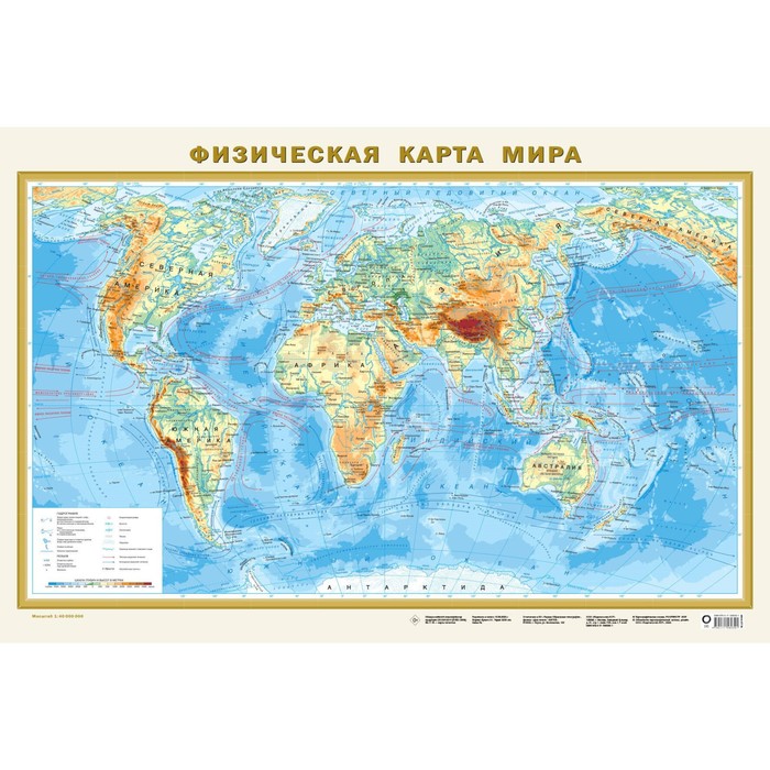
A physical map of the world of scale 1:40 000 000 (1 cm 400 km) clearly demonstrates the distribution of mountain, plain and intermediate types of relief over the surface of land land. Punch with high -altitude marks shows the highest peaks of all continents and main mountain systems. The objects of the hydrological network on the map include the largest rivers with tributaries and lakes. The relief of the bottom of the oceans with the release of ridges, basins and deep -sea grooves with their greatest depths is also presented. The oceans show warm and cold currents.
This wall map, covered on the front side of the anti -bend polymer film, has dimensions of 870x580 mm.
The card is packed in a transparent tube (a package made of soft plastic with a volumetric bottom and euroslot). The dimensions of the tube: length 59 cm, diameter 5 cm.
| Characteristics | |
| A country | Russia |
| Age | From 6 years |
| Author | There is no author |
| Format | A1 |
| Number of pages | 2 |
| School subject | Geography |
| The theme of the encyclopedia | Geography, travel |
| The year of publishing | 2023 |
There are no reviews for this product.