Political and physical map of the world, within new borders, a1


This wall map, covered on both sides by a polymer film, has a size of 870x580 mm. It consists of two cards of the same scale 1:40 000 000 (1 cm 400 km).
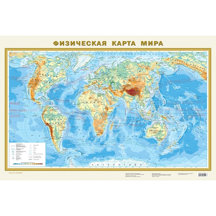
The physical map of the world clearly reflects the distribution of mountainous, plain and derivative types of relief on the surface of the land of the Earth. Punch with high -altitude marks shows the highest peaks of all continents and main mountain systems. The objects of the hydrological network on the map include the largest rivers with tributaries and lakes. The relief of the bottom of the oceans with the release of ridges, basins and deep -sea grooves with their greatest depths is also presented. The oceans show warm and cold currents.
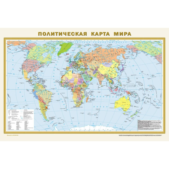
The political map shows all the independent states of the world with their capitals, as well as possessions and territories with special status. Russia is represented within the new borders: with the Donetsk and Lugansk People’s Republics, Zaporizhzhya and Kherson regions, the Republic of Crimea and Sevastopol. The settlements on the map are given in three gradations of the number: more than 1 million inhabitants, from 100 thousand to 1 million, less than 100 thousand inhabitants.
Recommended for a wide range of users.
| Characteristics | |
| A country | Russia |
| Author | There is no author |
| Format | A1 |
| Number of pages | 2 |
| School subject | Geography |
| The subject of the book | Natural Sciences |
| The year of publishing | 2023 |
There are no reviews for this product.