Political and physical map of the world, within new boundaries
$5.58
In Stock
Characteristics
A country
Russia
Author
There is no author
Number of pages
2
School subject
Geography
The subject of the book
Natural Sciences
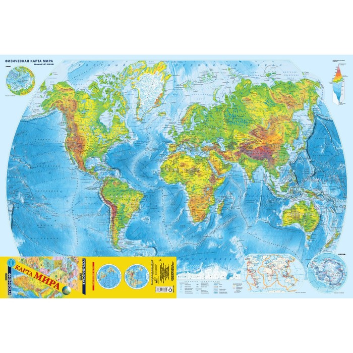
This updated bilateral folding card has a wiped format of 990x680 mm. In folded form, with a size of 247.5 x 113.3 mm, it easily fits in a pocket. On one side of the sheet is a colorful physical map of the world of scale 1:37 500,000, supplemented by cards of the Arctic and Antarctica, on the other side-a political map of the world of scale 1:37 500,000 with a map of Europe on a scale of 1:20,000,000. Each of the The states of the world are given with its official flag. Russia is represented within the new borders: with the Donetsk and Lugansk People’s Republics, Zaporizhzhya and Kherson regions, the Republic of Crimea and Sevastopol.
The additional maps also show the main international organizations.
| Characteristics | |
| A country | Russia |
| Author | There is no author |
| Number of pages | 2 |
| School subject | Geography |
| The subject of the book | Natural Sciences |
| The year of publishing | 2023 |
Write a review
There are no reviews for this product.