Political map of the world A0. Within new boundaries
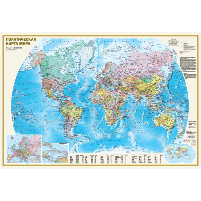
On a political map of scale 1:32 000 000 (1 cm 320 km), all independent states of the world are represented (Russia is given within new borders), as well as dependent territories and territories with special status. Well -distinguishable punchs are shown settlements with gradations “more than 1 million inhabitants”, “From 100 thousand to 1 million inhabitants” and “less than 100 thousand inhabitants”. The main railway and road routes are reflected. The sea routes are given with a kilometer.
The main card is supplemented by inserts on a larger scale to Europe and the Caribbean region, as well as the “population density” map. The tabular form shows data on the largest countries of the world in the population, area, as well as on the main urban agglomerations of the world.
The dimensions of the card 1170x790 mm, anti -reflective coating.
The political map of the world is packed in a transparent tube (a bag with a volumetric bottom and euroslot) made of soft plastic. Tubus dimensions: length 800 mm, diameter 50 mm.
| Characteristics | |
| A country | Russia |
| Author | There is no author |
| Number of pages | 2 |
| The subject of the book | Natural Sciences |
| The year of publishing | 2024 |
There are no reviews for this product.