Russian map in new borders. Political. Physical
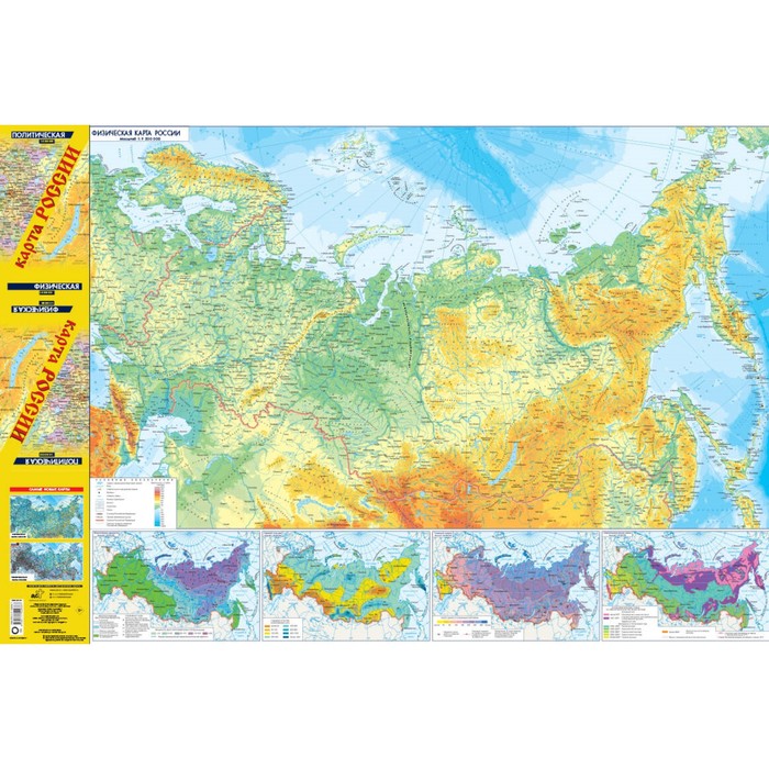
On the updated two -way folding map of the 990x680 mm format, on the one hand, the physical map of Russia scale 1: 9 500 000, reflecting the features of the country's relief and hydrography within new boundaries, and on the other hand, is a political map of Russia scale 1: 8 500 000 , which reflects all 89 constituent entities of the Russian Federation (updating the Donetsk and Lugansk People’s Republics, the Republic of Crimea and the city of Sevastopol, Zaporizhzhya and Kherson regions) consisting of 8 federal districts. The main maps are supplemented by cards (on a scale of 1:38,000,000) of the spread of many years of permafrost, the values of the annual drainage of rivers, the thickness of the snow cover, agroclimatic belts, as well as the map “The Peoples of Russia” in a scale of 1:25,000,000.
| Characteristics | |
| A country | Russia |
| Author | There is no author |
| Classroom | 11 |
| Compliance with the standard (GEF) | No |
| Number of pages | 2 |
| School subject | Story |
| The year of publishing | 2024 |
There are no reviews for this product.